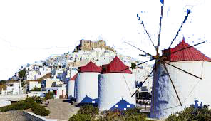
Cruise to the Dodecanese Islands
4th Grade – Language – Unit 16 Travel in Greece – Grammar – Comparison
(Greek educational system)
|
|
Materials for the lessonPaper size A4Photos of Dodecanese islandsCards printed containing very simple information about Dodecanese islandsMarkers in different colorsPen or pencilsA map of Greece (school material)A bell |
Layout of the classroomDuring Phase 1 the students may be seated as usual.During Phases 2,3 and 4, free space is necessary for the students to move, so desk and chairs are placed on the edges. |
|
Phase 1The teacher has printed cards with simple information about Dodecanese islands. Each card concerns one island and contains elements about its area, population, municipality density, distance between the island and Piraeus port or whatever the teacher thinks appropriate. It is recommended not more than 3-4 elements, common for all the islands. The teacher puts the cards in a box.The teacher hangs a map of Greece on the wall so everybody can read it.The students are divided into pairs and each pair pulls out of the box one card-island. On a paper sized A4, each pair, with different color marker, draws the outline of the island, consulting the school map of Greece and writes on it, its name. |
|
Phase 2The teacher defines a space in the classroom telling that is the Aegean Sea. He/she asks all children to place their Dodecanese island in this Sea.Once the teacher’s bell rings, all the pairs move in the defined area, trying to place the paper of their island on the floor in a way similar to the map. This action needs cooperation and interaction between all pairs.The bell rings again and the action stops. The teacher checks the result and gives a second chance for the pairs to correct. |
|
Phase 3Each pair takes the card with the information and stands on its island.Τhe teacher says the names of 2 islands and the pairs who have the card of these islands should read loudly the information of the cards, make the comparison and say the conclusion.For example:The teacher calls: Rhodes, PatmosThe pair who has the card of Rhodes, reads loudly:– Area: 1,401 km2Patmos’ pair answers loudly:– 34.142 km2Rhodes’ pair says:– Rhodes is bigger than Patmos.Patmos pair says:-Patmos is smaller than Rhodes.They continue with the second/third/fourth information in the same way.The same procedure is repeated so all pairs can make comparisons and use the comparative degree to express it. |
|
Phase 4The teacher’s bell rings and the pairs leave their card on their island and change island.The same procedure is repeated so all children could use comparative degree. |
|
Phase 5The teacher calls 3 islands this time. The procedure is the same: the children read, compare and end up with a different conclusion.For example:The teacher designs Phodes, Karpathos and Patmos.After reading the area of these three islands, Phodes pair says:-Rhodes is the biggest of these three islands.Patmos pair says:-Patmos is the smallest of these three islands.The teacher’s bell rings and the pairs leave their card on their island and change island.The same procedure is repeated so all children could use the superlative degree to compare more than 2 things. |
|
Phase 6All pairs get pictures of Dodecanese islands, compare the images and write impressions, conclusions.Pairs exchange their work and check if the adjectives are in positive, comparative or superlative degree. |